Friday, April 9, 2010

National Highways in India

 National Highways


India has a huge network of national highways. The national highways have a total length of 70,548 kms. Indian highways cover 2% of the total road network of India and carry 40% of the total traffic. The entire highway network of India is managed by the National Highway Authority of India which is responsible for development and maintenance of highways.

The longest highway in India is NH7 which stretches from Varansi in Uttar Pradesh to Kanyakumari in the southern most point of Indian mainland. The shortest highway is NH47A which stretches from Ernakulam to Kochi and covers total length of 4 Kms. 


Andhra Pradesh

S.No. NH No. Route Length in the State
1 5 Junction with National Highways No. 6 near Baharagora-Cuttack-Bhubaneshwar-Vishakhapatnam -Vijayawada-Chennai 1,000 km (620 mi)
2 7 Varanasi-Mangawan-Salem-Dindigul-Madurai-Cape-Commorin(Kanyakumari) 754 km (469 mi)
3 9 Pune-Sholapur-Hyderabad-Vijayawada-Machilipatnam 430 km (270 mi)
4 16 Nizamabad - Armoor - Jagtial -- Mancherial - Chinnur up to Maharashtra Border 220 km (140 mi)
5 18 Kurnool - Nandyal - Allagadda - Mydukur - Cuddapah - Rayachoti - Pileru- Chittoor 369 km (229 mi)
6 43 From Orissa Border - Salur - Ramabhadrapuram - Vizianagaram and terminating at NH 5 near Natavalasa Junction proceeding towards Srikakulam and near Rajapulova Junction proceeding towards Visakhapatnam 83 km (52 mi)
7 63 From Karnataka Border - Guntakal - Gooty 62 km (39 mi)
8 163 Hyderabad - Warangal - Venkatapuram up to Chhattisgarh Border 244 km (152 mi)
9 205 Anantapur - Kadiri - Madanapalle - Vayalpadu - Pileru - Tirupati - Renigunta - Puttur - Nagari up to Tamil Nadu Border 360 km (220 mi)
10 214 The highway starting from the junction of NH 5 near Kathipudi - Pithapuram - Kakinada - Yanam - Amalapuram - Razole - Palakollu - Bhimavaram - Mudinepalli-Gudivada -and terminating at NH 9 near Pamarru 270 km (170 mi)
11 214A The highway starting from the junction of NH 214 near Digamarru connecting Narsapuram - Machilipatnam - Challapalli - Avanigadda - Repalle - Bapatla - Chirala and terminating at NH 5 near Ongole 255 km (158 mi)
12 219 Madanapalle - Punganuru - Palmaner - Kuppam up to Tamil Nadu Border 128 km (80 mi)
13 221 The Highway starting from the junction of NH9 near Ibrahimpatnam connecting Kondapalli - Mylavaram - Cheemalapadu - Tiruvuru - Penuballi - Kothagudem - Paloncha - Bhadrachalam - Nellipaka - Chinturu - Konta up to Chhattisgarh border 155 km (96 mi)
14 222 From Maharashtra border to - Bhainsa - junction with NH7 near Nirmal 60 km (37 mi)
15 234 From Karnataka border to - Venkatagirikota - Pernampattu - up to Tamil Nadu Border 23 km (14 mi)
16 4 From Karnataka border to - Palamaner - Chittoor - up to Tamil Nadu Border 83 km (52 mi)
- - Total 4,496 km (2,794 mi)

Arunachal Pradesh

S.No. NH No. Route Length
1 52 From Assam Border - Pasighat - Dambuk - Roing - Paya - Tezu - Wakro - Namsai up to Assam Border 310 km (190 mi)
2 52A From Assam Border - Itanagar up to Assam border 42 km (26 mi)
3 153 From Assam Border - Myanmar border 40 km (25 mi)
4 229 Tawang - Pasighat 1,090 km (680 mi)
- - Total 1,482 km (921 mi)

Assam

S.No. NH No. Route Length (km.)
1 31 From W.B. Border - Gouripur - North Salmara - Bijni - Amingaon, Junction with NH 37 322 km (200 mi)
2 31B North Salmara - Junction with NH 37 near Jogighopa 19 km (12 mi)
3 31C From W.B. Border - Kochgaon - Sidli Jn. With NH 31 near Bijni 93 km (58 mi)
4 36 Nagaon - Dabaka - Amlakhi - Nagaland Border 167 km (104 mi)
5 37 Junction with NH 31B near Goalpara - Paikan - Guwahati - Dispur - Nowgaon - Numaligarh - Jorhat - Jhanzi - Dibrugarh - Tinsukia - Makum - Saikhoaghat 680 km (420 mi)
6 37A Kuwarital – Junction with NH 52 near Tezpur 23 km (14 mi)
7 38 Makum - Ledo - Lekhapani 54 km (34 mi)
8 39 Numaligarh - Naojan - Bokajan up to Nagaland Border 115 km (71 mi)
9 44 From Meghalaya Border - Badarpur - Karimganj - Patharkandi up to Tripura Border 111 km (69 mi)
10 51 Paikan up to Meghalaya Border 22 km (14 mi)
11 52 Baihata - Charali - Mangaldai - Dhekiajuli - Tezpur - Gohpur - Banderdewa - North Lakhimpur - Dhemaji - Kulajan - Arunachal Border - Junction with NH No.37 near Saikhoaghat 540 km (340 mi)
12 52A Gohpur - A.P. Border - Banderdewa 15 km (9.3 mi)
13 52B Kulajan - Dibrugarh 31 km (19 mi)
14 53 Junction with NH 44 near Badarpur - Silchar - Lakhipur up to Manipur Border. 100 km (62 mi)
15 54 Dabaka - Lumding - Langting - Hablong - Silchar - Dwarband up to Mizoram Border 338 km (210 mi)
16 61 Jhanzi - Amguri - Nagaland border 20 km (12 mi)
17 62 Dudhnai - Damara up to Meghalaya Border 5 km (3.1 mi)
18 151 Karimganj - Bangladesh Border 14 km (8.7 mi)
19 152 Patacharkuchi - Hajua - Bhutan Border 40 km (25 mi)
20 153 Ledo - Lekhapani - Arunachal Pradesh Border 20 km (12 mi)
21 154 Dhaleshwar (Badarpur) - Bairabi - Mizoram Border 110 km (68 mi)
- - Total 2,836 km (1,762 mi)

Bihar

NH Route inside Bihar Complete Route Length in State (km) Total Length
2 Uttar Pradesh border – Mohania – Kudra – Sasaram – Dehri – Aurangabad – Madanpur – Dobhi – Barachati – Jharkhand border Delhi – Mathura – Agra – Kanpur – Allahabad – Varanasi – Mohania – Barhi – Palsit – Baidyabati – Calcutta Delhi (12), Haryana (74), Uttar Pradesh (752), Bihar (202), Jharkhand (190), West Bengal (235) 1465
19 Uttar Pradesh border – Manjhi – Chhapra – Sonpur – Hajipur – Patna Ghazipur – Balia – Manjhi – Chhapra – Sonpur – Hajipur – Patna Bihar (120), Uttar Pradesh (120) 240
28 Junction with NH 31 – Barauni – Bachwara – Tajpur – Muzaffarpur – Mehsi – Chakia – Gopalganj – Uttar Pradesh border Junction with NH 31 – Barauni – Muzaffarpur – Pipra – Kothi – Gorakhpur – Lucknow Bihar (259), Uttar Pradesh (311) 570
28A Junction with NH 28 – Pipra – Kothi – Sagauli – Raxaul – Indo-Nepal Border Junction with NH 28 – Pipra – Kothi – Sagauli – Raxauli – Indo-Nepal border Bihar (68) 68
28B Chapra – Bettiah – Lauriya – Bagaha – Chhitauni – Uttar Pradesh Border Chapra – Bettiah – Lauriya – Bagaha – Chhitauni – Uttar Pradesh border Bihar (121)
30 Junction with 2 – Mohania – Kochas – Dinara – Bikramganj – Arrah – Danapur – Patna – Fatuha – Bakhtiarpur Junction with NH 2 – Mohania – Arrah – Patna – Bakhtiarpur Bihar (230) 230
30A Fatuha – Chandi – Harnaut – Barh Fatuha – Chandi – Harnaut – Barh Bihar (65) 65
31 Jharkhand border – Rajauli – Nawada – Bihar Sharif – Bakhtiarpur – Barh – Mokameh – Barauni – Begusarai – Balia – Khagaria – Bihpur – Kursela – Purnia – Baisi – West Bengal – Kishanganj – West Bengal border Junction with NH 2 – Barhi – Bakhtiarpur – Mokameh – Purnea – Dalkola – Siliguri – Sevok – Cooch Behar – North Salmara – Nalbari – Charali – Amingaon Junction with NH 37 Bihar (393), West Bengal (366), Assam (322), Jharkhand (44) 1125
57 Muzaffarpur – Darbhanga – Jhanjharpur – Narahia – Narpatganj – Forbesganj – Araria – Purnia Muzaffarpur – Darbhanga – Jhanjharpur – Narahia – Narpatganj – Forbesganj – Araria – Purnia Bihar (310) 310
57A Junction with 57 – Forbesganj – Jogbani Junction with NH 57 – Forbesganj – Jogbani Bihar (15) 15
77 Hajipur – Muzaffarpur – Sitamarhi – Sonbarsa Hajipur – Muzaffarpur – Sitamarhi – Sonbarsa Bihar (142) 142
80 Mokamah – Luckeesarai – Munger – Bhagalpur – Kahalgaon – Jharkhand border Mokamah – Luckeesarai – Munger – Bhagalpur – Kahalgaon – Rajmahal – Farrakka Bihar (200), Jharkhand (100), West Bengal (10) 310
81 Kora – Katihar – Malda – West Bengal border Kora – Katihar – Malda – West Bengal Border Bihar (45), West Bengal (55) 100
82 Gaya – Hisua — Rajgir – Bar Bigha – Bihar Sharif – Mokameh Gaya – Hisua — Rajgir – Bar Bigha- Bihar Sharif – Mokameh Bihar (130) 130
83 Patna – Jehanabad – Bela – Gaya – Bodhgaya – Dobhi Patna – Jehanabad – Bela – Gaya – Bodhgaya – Dobhi Bihar (130) 130
84 Arrah – Buxar Arrah – Buxar Bihar (60) 60
85 Chhapra – Ekma – Siwan – Gopalganj Chhapra – Ekma – Siwan – Gopalganj Bihar (95) 95
98 Patna – Arwal – Daudnagar – Aurangabad – Rajhara – Amba – Jharkhand border Patna – Arwal – Daudnagar – Aurangabad – Rajhara – Amba – Jharkhand border Bihar (156), Jharkhand (51) 207
101 Chhapra – Baniapur – Mohammadpur Chhapra – Baniapur – Mohamadpur Bihar (60) 60
102 Chhapra – Rewaghat – Muzaffarpur Chhapra – Rewaghat – Muzaffarpur Bihar (80) 80
103 Hajipur – Hazrat Jandaha – Mushrigharari Hajipur – Hazrat Jandaha – Mushrigharari Bihar (55) 55
104 Chakia – Madhubani – Jaynagar – Shivhar – Sitamarhi – Sursand – Jaynagar – Narahia Chakia – Madhubani – Jaynagar – Shivhar – Sitamarhi – Sursand – Jaynagar – Narahia Bihar (160) 160
105 Darbhanga – Aunsi – Jaynagar Darbhanga – Aunsi – Jaynagar Bihar (66) 66
106 Birpur – Pipra – Madhepura – Kishanganj – Bihpur Birpur – Pipra – Madhepura – Kishanganj – Bihpur Bihar (130) 130
107 Maheshkhunt – Sonbarsa Raj – Simri-Bakhtiarpur – Bariahi – Saharsa –Madhepura – Banmankhi – Purnia Maheshkhunt – Sonbarsa Raj – Simri Bakhtiarur – Bariahi – Saharsa – Madhepura – Banmankhi – Purnia Bihar (145) 145
110 Junction with NH 98 – Arwal – Jehanabad – Bandhuganj – Kako – Ekangarsarai – Bihar Sharif – Junction with Junction with NH 98 – Arwal – Jehanabad – Bandhuganj – Kako – Ekangarsarai – Biharsharif – Junction with NH 31 Bihar (89) 89

Chandigarh

S.No. NH No. Route Length (km.)
1 21 Starting from Punjab Mohali Town Border – Chandigarh up to Haryana Border (Ambala District) 24 km (15 mi)

Chhattisgarh

S.No. NH No. Route Length (km.)
1 53 From Maharashtra Border - Baghnadi - Chichola - Rajnandgaon - Durg - Bhilai - Raipur - Arang - Pithora - Basna - Saraipali - up to Orissa Border 314 km (195 mi)
2 12A From M.P. Border - Chilpi - Kawardha - Pipariya - Bemetara - Simga 128 km (80 mi)
3 16 From Maharashtra Border - Bhopalpatnam - Bijapur - Bhairamgarh - Gidam - Jagdalpur 210 km (130 mi)
4 30 Raipur - Deori - Dhamtari - Charama - Kanker - Keskal - Pharasgaon - Kondagaon - Jagdalpur up to Orissa Border 316 km (196 mi)
5 78 From M.P. Border - Mahendragarh - Baikunthpur - Surajpur - Ambikapur - Kunkuri - Pathalgaon - Raikera - Jashpurnagar - Rupsera - Jharkhand Border 356 km (221 mi)
6 111 Bilaspur - Ratanpur - Katghore - Kendai - Surajpur 200 km (120 mi)
7 200 Raipur - Simga - Baitalpur - Bilaspur - Ramgarh - Champa - Sakti - Uravmiti - Raigarh up to Orissa Border 300 km (190 mi)
8 202 Bhopalpatnam - Bhadrakali - Kotturu up to A.P. Border 36 km (22 mi)
9 216 Raigarh - Sarangarh - Saraipali 80 km (50 mi)
10 217 Raipur - Mahasamund - Suarmar-Kunkuri-Jashpur up to Orissa Border 70 km (43 mi)
11 221 From A.P. Border Konta - Sukma - Kukanar - Darba - Sosanpal - Terminating junction with NH16 near Jagadalpur 280 km (170 mi)
--Total 2,290 km (1,420 mi)

Delhi

S.No. NH No. Route Length (km.)
1 1 Outer Ring Road/ Transport Nagar - Haryana Border 22 km (14 mi)
2 2 NH2/Ring Road - Delhi Capital - Haryana Border 12 km (7.5 mi)
3 2 From Delhi to Faridabad 4.4 km (2.7 mi)
4 8 Ring Road –Haryana Border 13 km (8.1 mi)
5 10 Outer Ring Road - Mundka - Haryana Border 18 km (11 mi)
6 24 Nizamuddin Road - U.P.border. 7 km (4.3 mi)
- - Total 76.4 km (47.5 mi)

Goa

S.No. NH No. Route Length (km.)
1 4A From Karnataka Border - Darbandora - Ponda - Bhoma - Banastari - Panaji 171 km (106 mi)
2 17 From Maharashtra Border - Pernem - Mapuca - Panaji - Cortalim - Verna - Margao - Cuncolim - Chauri (Chauri) - Polem up to Karnataka Border 139 km (86 mi)
3 17A Cortalim (Kortali) - Sancoale - Chicalim - Murmugao 19 km (12 mi)
4 17B Ponda - Verna - Vasco da Gama 40 km (25 mi)

Gujrat

S.No. NH No. Route Length (km.)
1 NE-1 Ahmedabad - Vadodara Expressway 93 km (58 mi)
2 6 Hajira - Surat - Bardoli - Vyara - Songadh up to Maharashtra Border 177 km (110 mi)
3 8 From Rajasthan Border - Himatnagar - Ahmadabad - Anand - Vadodara - KarjanBharuch - Ankleshwar - Chalthan (Surat) - Navsari - Valsad - Vapi - Maharashtra Border 498 km (309 mi)
4 8A Ahmedabad - Bagodra - Limbdi - Bamanbore - Morbi - Samakhiali - Kandla – Mandvi - Vikhadi - Kothara - Naliya up to Narayan Sarovar 618 km (384 mi)
5 8B Bamanbore - Rajkot - Gondal - Jetpur - Dhoraji - Kutiyana - Porbandar 206 km (128 mi)
6 8C Chiloda - Gandhinagar - Sarkhej 46 km (29 mi)
7 8D Jetpur - Junagadh - Maliya - Somnath 127 km (79 mi)
8 8E Dwarka - Porbandar - Navibabder - Somnath - Kodinar - Una - Mahuva - Talaja - Bhavnagar 445 km (277 mi)
9 14 From Rajasthan Border - Palanpur - Deesa - Sihori - Radhanpur 140 km (87 mi)
10 15 Samakhiali - Santalpur - Radhanpur - Bhaghar - Tharad up to Rajasthan Border 270 km (170 mi)
11 59 Ahmedabad - Kathua - Godhra - Dahod up to M.P. Border 211 km (131 mi)
12 113 Dahod - Limdi - Zalod - Rajasthan Border. 40 km (25 mi)
13 228 Dandi heritage route Sabarmati Ashram - Aslali - Navagam - Matar - - Anand - Borsad - Kankapura - Kareli - Ankhi - Amod - Derol - Ankleshwar - Mangrol - Umrachi - Bhatgam - Delad - Surat - Vanjh - Navsari - Kardi - Dandi 374 km (232 mi)
- - Total 3,245 km (2,016 mi)

Himachal Pradesh

S.No. NH No. Route Length (km.)
1 1A From Punjab Border - Kathua - Samba - Jammu - Nagrota - Udhampur - Batot - Ramban - Khanabal - Awantipora - Pampore - Srinagar - Pattan - Baramula - Uri 541 km (336 mi)
2 National Highway 154 (India)154 Pathankot - Mandi 220 km (140 mi)
3 21 Chandigarh - Ropar - Mandi - Kullu - Manali 323 km (201 mi)
4 21A Pinjore - Swarghat 65 km (40 mi)
5 22 Ambala - Shimla - Khab 459 kilometres (290 mi)
6 70 Jalandhar - Mandi 170 km (110 mi)
7 72 Ambala - Nahan - Haridwar 200 km (120 mi)
8 73A Yamuna Nagar - Paonta Sahib 62 km (39 mi)
9 88 Kangra - Shimla 224 km (139 mi)

Jammu and Kashmir

S.No. NH No. Route Length (km.)
1 1A From Punjab Border - Kathua - Samba - Jammu - Nagrota - Udhampur - Batot - Ramban - Khanabal - Awantipora - Pampore - Srinagar - Pattan - Baramula - Uri 541 km (336 mi)
2 1B Batote - Doda - Kistwar - Symthanpass - Khanabal 274 km (170 mi)
3 1C Domel - Katra 8 km (5.0 mi)
4 1D Srinagar - Kargil - Leh 422 km (262 mi)

Jammu and Kashmir

Karakoram Highway
Sign Name Route Lanes Length  Remarks
Hasan Abdal to Khunjerab Pass 2 Lanes 806 km

S-1(in Pakistan) Extends from Gilgit to Skardu
167 km

S-2(in Pakistan) Extends from Kohala to Muzaffarabad
40 km

S-3(in Pakistan) Extends from Muzaffarabad to Chakothi
55 km

Jharkhand

S.No. NH No. Route Length (km.)
1 2 From Bihar Border - Chauparan - Barhi - Barakatha - Bagodar - Dumri - Topchanchi - Gobindpur - Nirsa - Maithan Dam up to West Bengal Border 190 km (120 mi)
2 6 From Orissa Border - Baharagora up to W.B. Border 22 km (14 mi)
3 23 Chas(Bokaro Steel City) - Gola - Ramgarh - Ranchi - Bero - Sisai - Gumla - Palkot - Kolebira - Simdega - Orissa Border 250 km (160 mi)
4 31 Jn. with NH2 near Barhi - Kodarama up to Bihar border 44 km (27 mi)
5 32 Junction with NH2 near Govindpur - Dhanbad - Chas(Bokaro Steel City) - West Bengal Border - Chandil - Jamshedpur 107 km (66 mi)
6 33 Junction with NH2 near Barhi - Hazaribag - Ramgarh - Ranchi - Bundu - Chandil - Jamshedpur- Mahulia - Junction with NH6 near Baharagora 352 km (219 mi)
7 75 From UP Border - Nagar untari - Garhwa - Daltonganj - Latehar - Chandwa - Kuru - Mandar - Ranchi - Khunti - Band Gaon - Chakradharpur - Chaibasa - Jainitgarh up to Orissa Border. 447 km (278 mi)
8 78 From Chhattisgarh Border - Silam - Gumla 25 km (16 mi)
91 80 From Bihar Border - Sahibganj - Talihari - Rajmahal - Barharwa up to West Bengal Border 100 km (62 mi)
10 98 From Bihar Border - Hariharganj - Chhatarpur terminating near Rajhara at NH75 50 km (31 mi)
11 99 Chandwa - Balumath - Chatra - Hunterganj up to Bihar Border 156 km (97 mi)
12 100 Chatra - Tutilawa - Hazaribagh - Meru - Daru-Kharika - Bagodar 118 km (73 mi)

Karnataka

S.No. NH No. Route Length (km.)
1 4 From Maharashtra border - Nippani - Sankeshwar - Belgaum - Dharwad - Hubli - Haveri - Ranebennur - HariharDavangere - Chitradurga - Sira - Tumkur - Nelamangala - Bangalore - Hoskote - Kolar - Mulbagal - Up to Andhra Pradesh border 700 km (430 mi)
2 4A Belgaum - Khanapur - Gunji - Up to Goa border 82 km (51 mi)
3 7 From Andhra Pradesh border - Chik Ballapur - Devanahalli - Bangalore-Electronics City - Chandapura - Attibele - Up to Tamil Nadu border 125 km (78 mi)
4 9 From Maharashtra border - Rajeshwar - Homnabad - Mangalgi - Up to Andhra Pradesh border. 75 km (47 mi)
5 13 From Maharashtra border - Horti - Bijapur - Hungund - Kushtagi - Hospet - Jagalur - Chitradurga - Holalkere - Bhadravati - Shimoga - Tirthahalli - Karkal - Mangalore 719 km (447 mi)
6 17 From Goa border - Karwar - Ankola - Kumta - Honavar - Bhatkal - Kundapura - Udupi - Surathkal-Mangalore - Talapady - Up to Kerala border. 300 km (190 mi)
7 75 Nelamangala - Kunigal - Channarayapatna - Hassan - Alur - Sakleshpur - Uppinangadi - Mangalore 328 km (204 mi)
8 63 Ankola - Yellapur - Kalghatgi - Hubli - Gadag - Koppal - Hospet - Bellary up to Andhra Pradesh border 370 km (230 mi)
9 67 Gundlupet - Bandipur up to Tamil Nadu border 50 km (31 mi)
10 206 Tumkur - Tiptur - Arsikere - Kadur - Bhadravati - Shimoga - Sagara - Honavar and terminating at its junction with NH No.17 in Honavar. 363 km (226 mi)
11 207 From Tamil Nadu border - Sarjapur - Hoskote - Devanhalli - Doddaballapura -Dobbaspet 135 km (84 mi)
12 209 From Tamil Nadu border - Chamrajnagar - Kollegal - Malavalli - Kanakapura - Bangalore 170 km (110 mi)
13 212 From Kerala border - Gundlupet - Nanjangud - Mysore - T Narsipur - Kollegal 160 km (99 mi)
14 218 Hubli - Nargund - Kerur - Bijapur - Sindgi - Jevargi - Gulbarga and terminating at its junction with NH No.9 near Homnabad 399 km (248 mi)
15 234 Mangalore - Belthangady - Mudigere - Belur - Huliyar - Sira - Madhugiri - Gauribidanur - ChintamaniSrinivasapur - Up to Andhra Pradesh Border 509 km (316 mi)

Kerala

Main article : Roads in Kerala
S.No. Route Length (km.)
1 17 Karnataka Border - Manjeshwar - Kasaragod - Kanhangad - Payyannur - Kannur - Thalassery- Vadakara - Kozhikode (Calicut) - Feroke - Kottakkal - Valanchery - Kuttipuram - Ponnani - Chavakkad - Kodungallur - North Paravur Junction with NH 47 at Edappally, Kochi 421 km (262 mi)
2 47 Tamil Nadu Border - Walayar - Palakkad (Palghat) - Alathur - Mannuthy - Chalakudy - Angamaly - Aluva - Kochi (Edapally) - Kochi (Vytilla) - Cherthala - Alappuzha (Alleppey) - Kayamkulam - Kollam - Thiruvananthapuram - up to Kaliyakkavilai in Tamil Nadu border. 417 km (259 mi)
3 47A Kochi byepass (Kundanur) Junction with 47 - Willingdon Island 6 km (3.7 mi)
4 47C Kochi bypass (Kalamasserry Junction) with 47 - Vallarpadam 17.2 km (10.7 mi)
5 49 Kochi bypass (Kundanur Junction). - Thripunithura - Muvattupuzha - Kotamangalam - Adimali - Devikulam up to Tamil Nadu Border 167 km (104 mi)
6 208 Kollam - Kottarakara - Punalur - Thenmala - Aryankavu up to Tamil Nadu border 81 km (50 mi)
7 212 Kozhikode - Thamarassery - Kalpetta - Sultan Battery up to Karnataka Border 119 km (74 mi)
8 213 Palakkad - Mannarkkad - Perinthalmanna - Malappuram - Junction with NH 17 at Ramanattukara 125 km (78 mi)
9 220 Kollam - Kadavoor - Kundara - Kottarakara - Adoor - Pandalam - Chengannur - Thiruvalla - Changanassery - Kottayam - Ponkunnam - Kanjirapally - Mundakayam - Peermade - Vandiperiyar - Kumily up to Tamil Nadu border 190 km (120 mi)

Madhya Pradesh

S.No. NH No. Route Length (km.)
1 3 Rajasthan border – Morena - Gwalior - Shivpuri - Guna - Biaora - Pachore - Sarangpur - Shajapur - Maksi - Dewas - Indore - Thikri - Sendhwa - up to Maharashtra border 712 km (442 mi)
2 7 From UP border - Mauganj - Mangawan - Rewa - Katni - Jabalpur - Lakhnadon - Seoni - Gopalganj - Khawasa up to Maharashtra border. 504 km (313 mi)
3 12 Jabalpur - Shahpura - Bareli - Obedullaganj - Bhopal - Narsinghgarh - Biaora - Rajgarh - Khilchipur up to Rajasthan border 490 km (300 mi)
4 12A From the northern border with Uttar Pradesh - Orchha - Pirthipur - Tikamgarh - Shahgarh - Damoh - Tendukheda - Jabalpur - Mandla - Bichhi to the Chhattisgarh border at Chilpi 482 km (300 mi)
5 25 Shivpuri - Karera - UP border 82 km (51 mi)
6 26 From UP border - Barodia - Sagar - Deori - Narsimhapur - Lakhnadon 268 km (167 mi)
7 26A The highway starting from its junction with NH86 near Sagar - connecting Jeruwakhera - Khurai and terminating at Bina 75 km (47 mi)
8 27 From UP border - Sohagi - Mangawan 50 km (31 mi)
9 59 From Gujarat border - Jhabua - Dhar - Indore 139 km (86 mi)
10 59A Indore - Kannod - Khategaon - Harda - Sodalpur - Betul 264 km (164 mi)
11 69 Bhopal - Obedullaganj - Hoshangabad - Itarsi - Shahpur - Betul - Pandhurna - Chicholi - Maharashtra border 330 km (210 mi)
12 75 Gwalior - Datia - U.P. Border - Alipura - Chhatarpur - Panna - Satna - Rewa - Sidhi - Bargana - UP border 600 km (370 mi)
13 76 From Rajasthan border - Kota - Shivpuri 60 km (37 mi)
14 78 Katni - Umaria - Shahdol - Anupur - Chhattisgarh border 178 km (111 mi)
15 79 Rajasthan border - Nimach - Mandsaur - Ratlam - Ghata Bilod - Indore 280 km (170 mi)
16 86 From UP border - Chhatarpur - Hirapur - Banda - Sagar - Rahatgarh - Vidisha - Raisen - Bhopal - Sehore - Ashta - Dewas 494 km (307 mi)
17 86A The highway starting from its junction with NH86 near Rahatgarh connecting Begamganj - Gairatganj - and terminating at its junction with NH86 in Bhopal 176 km (109 mi)
18 92 From UP border - Bhind - Mahgawan - Gwalior 96 km (60 mi)

Maharashtra

S.No. NH No. Route Length (km.)
1 3 From MP Border - Sangvi - Dhule - Malegaon - Chandwad - Pimpalgaon Baswant - Nashik road - Igatpuri - Bhiwandi - Thane - Mulund- Sion - Dadar - Mumbai|391 km (243 mi)
2 4 Junction with NH No.3 near Thane - Panvel - Pune - Satara- Amitkumar Jadhav Village - - Kolhapur - Kagal up to Karnataka border 371 km (231 mi)
3 4B Jawaharlal Nehru Port Trust NH No.4 near km 109 Palaspe 20 km (12 mi)
4 4C NH No.4 near Kalamboli at km 116 junction with NH No.4B km 16.687
5 6 From Gujarat border - Navapur - Visarwadi - Sakri - Dhule - Erandol - Jalgaon - Muktainagar - Malkapur - Khamgaon - Akola - Amravati - Nagpur - Bhandara - Deori - Raipur - Kolkata 813 km (505 mi)
6 7 From MP border - Deolapar - Nagpur - Hinganghat - Karanji up to Andhra Pradesh border. 232 km (144 mi)
7 8 From Gujarat border - Talasari - Bandra - Mumbai 128 km (80 mi)
8 9 Pune - Indapur - Solapur - Umarga up to Karnataka border. 336 km (209 mi)
9 13 Solapur - Nandnee - Karnataka border 43 km (27 mi)
10 16 From Andhra Pradesh border - Sironcha - Kopela up to Chhattisgarh Border 30 km (19 mi)
11 17 Panvel - Pen - Mahad - Poladpur - Khed - Asurde - Chiplun - Savarde - Sangameshwar - Hathkambe(Ratnagiri) - Pali - Lanja - Rajapur - Kharepatan - Kankavali - Kudal - Sawantwadi up to Goa border. 482 km (300 mi)
12 50 Nashik - Sinnar - Sangamner - Narayangaon - Rajgurunagar - Pune 192 km (119 mi)
13 69 Nagpur - Saoner up to MP border 55 km (34 mi)
14 204 Ratnagiri - Pali - Sakharpa - Malakapur - Shahuwadi - Kolhapur - Sangli - Pandharpur - Solapur - Tuljapur - Latur - Wardha - Nagpur 974 km (605 mi)
15 211 Solapur - Osmanabad - Beed - Gevrai - Aurangabad - Ellora - Chalisgaon - Dhule 600 km (370 mi)
16 222 The highway starting from the junction of NH3 near Kalyan and connecting Ahmadnagar - Pathardi - Parbhani - Nanded - Bhokar -up to Andhra Pradesh border. 550 km (340 mi)

Meghalaya

S.No. NH No. Route Length (km.)
1 40 From Assam border - Barni Hat - Shillong - Dauki - Jowai 216 km (134 mi)
2 44 Nongstoin - Shillong up to Assam border 277 km (172 mi)
3 51 From Assam border - Bajengdoda - Tura - Dalu 127 km (79 mi)
4 62 Damra - Dambu - Baghmara - Dalu 190 km (120 mi)

Mizoram

S.No. NH No. Route Length (km.)
1 44A From Tripura Border - Tukkalh - Mamit - Sairang - Aizawl 165 km (103 mi)
2 54 From Assam Border - Chhimlung - Bualpui - Aizawl - Zobawk - Pangzawl - Lawngtla - Tuipang 515 km (320 mi)
3 54A Theriat - Lunglei 9 km (5.6 mi)
4 54B Venus Saddle - Saiha 27 km (17 mi)
5 150 Aizawl - Phaileng - Thingsat up to Manipur Border 141 km (88 mi)
6 154 From Assam Border to Kanpui 70 km (43 mi)

Nagaland

S.No. NH No. Route Length (km.)
1 36 From Assam Border - Dimapur 3 km (1.9 mi)
2 39 From Assam Border - Dimapur - Kohima up to Manipur Border 110 km (68 mi)
3 61 Kohima - Wokhal - Mokokchung - Merang Kong up to Assam Border 220 km (140 mi)
4 150 From Manipur Border - Kohima 36 km (22 mi)
5 155 Mokokchung - Tuensang - Shamatore - Kiphire - Meluri up to Manipur Border 327 km (203 mi)

Orissa

S.No. NH No. Route Length (km.)
1 5 Junction with NH No.6 in Jharkhand near Baharagora - Baripada - Baleshwar - Bhadrak - Cuttack - Bhubaneswar - Khordha - Chhatrapur - Brahmapur up to Andhra Pradesh Border. 488 km (303 mi)
2 5A Junction with NH No.5 near Haridaspur - Paradip Port 77 km (48 mi)
3 6 From Chhattisgarh Border - Lobarchatti - Bargarh - Sambalpur - Deogarh - Barkote - Kendujhargarh - Jashipur - Bangriposi up to Jharkhand Border 462 km (287 mi)
4 23 From barhi - Panposh - Rourkela - Rajamunda - Barkote - Pala Laharha - Talcher - Jn. with NH42 209 km (130 mi)
5 42 Junction with NH No.6 near Sambalpur - Rairakhol - Anugul - Dhenkanal - Jn. with NH5 near Cuttack 261 km (162 mi)
6 43 From Chhattisgarh Border - Dhanpunji - Borigumma - Jaypur - Koraput - Sunki - Andhra Pradesh Border. 152 km (94 mi)
7 60 From West Bengal Border - Jaleswar l.n.road- Baleshwar 57 km (35 mi)
8 75 From Jharkhand Border to junction with NH No.215 near Parsora 18 km (11 mi)
9 200 From Chhattisgarh - Machida - Jharsuguda - Kochinda - Deogarh - Talcher - Kamakhyanagar - Sukinda - Chandikhole 440 km (270 mi)
10 201 Borigumma - Ampani - Bhawanipatna - Belgan - Balangir - Luisinga - Jogisuruda - Dunguripali - Bargarh 310 km (190 mi)
11 203 Bhubaneshwar - Pipili - Puri - Konark 97 km (60 mi)
12 203A The highway starting from its junction with NH203 at Puri, connecting Bramhagiri and terminating at Satpada 49 km (30 mi)
13 215 Panikoili -Jajpur Road - Anandapur - Ghatgan - Kendujhargarh - Parsora - Koira - Rajamunda 348 km (216 mi)
14 217 From Chhattisgarh Border - Nauparha - Khariar - Titlagarh - Belgan - Ramapur - Baligurha - Nuagaon - Raikia - G.Udayagiri - Kalinga - Bhanjanagar - Asika - Brahmapur - Narendrapur - Gopalpur 438 km (272 mi)
15 224 Khordha - Nayagarh - Dashapalla - Purunakatak - Bauda - Sonapur - Balangir 298 km (185 mi)

Punjab

S.No. NH No. Route Length (km.)
1 1 From Haryana Border - Rajpura - Khanna - Ludhiana - Phagwara - Jalandhar - Amritsar - Atari up to Pak Border 254 km (158 mi)
2 1A Jalandher - Dasuya - Pathankot up to J&K Border 108 km (67 mi)
3 10 From Haryana Border - Lambi - Malout - Abohar - Fazilka - Indo/Pak Border 72 km (45 mi)
4 15 Pathankot - Gurdaspur - Batala - Amritsar - Tarn Taran - Zira - Faridkot - Bhatinda - Malout - Abohar up to Rajasthan Border. 350 km (220 mi)
5 20 Pathankot and up to H.P. Border 10 km (6.2 mi)
6 21 From Chandigarh Border - Kharar - Kurali - Rupnagar - Ghanauli up to H.P. Border 67 km (42 mi)
7 22 From Haryana Border - Dera Bassi up to Haryana Border. 31 km (19 mi)
8 64 From Haryana Border - Banur - Rajpura - Patiala - Sangrur - Barnala - Rampura Phul - Bathinda up to Haryana Border. 255.5 km (158.8 mi)
9 70 Jalandhar - Hoshiarpur up to H.P. Border 50 km (31 mi)
10 71 Jalandher - Nakodar - Moga - Barnala - Dhanaula - Sangrur - Dogal up to Haryana Border. 130 km (81 mi)
11 72 From Haryana Border up to Haryana Border. 4.5 km (2.8 mi)
12 95 From Chandigarh Border - Kharar - Morinda - Ludhiana - Jagraon - Moga - Firozpur 225 km (140 mi)

Puducherry

NH No. S.No. Route Length (km.)
1 45A Villupuram - Pondicherry - Cuddalore - Chidambaram - Sirkazhi - Karaikal - Nagapattinam 147 km (91 mi)
2 66 Pondicherry - Tindivanam - Gingee - Thiruvannamalai - Chengam - Uthangarai - Krishnagiri 208 km (129 mi)

Rajasthan

S.No. NH No. Route Length (km.)
1 3 From UP Border - Majiyan up to MP Border 32 km (20 mi)
2 8 From Haryana Border - Ajarka - Behror - Kotputli - Manoharpur - Jaipur - Kishangarh - Ajmer - Beawar - Bhim - Dewair - Nathdwara - Udaipur - Khairwara - Bechiwara up to Gujarat Border 688 km (428 mi)
3 11 From UP Border - Bharatpur - Mahwa - Dausa - Jaipur - Ringas - Sikar - Fatehpur - Ratangarh - Dungargarh - and terminating at Bikaner on NH 15. 531 km (330 mi)
4 11A Manoharpur - Dausa - Lalsot and terminating at Kothum on NH 8. 145 km (90 mi)
5 11B The highway starting from its junction with NH 11A near Lalsot connecting Gangapur - Karauli - Sir Muthra - Angai - Barauli - Bari - and terminating at Dhaulpur on NH 3. 180 km (110 mi)
6 12 From MP Border - Ghatoli - Aklera - Jhalawar - Kota - Bundi - Devli - Tonk - Kothum - Jaipur 400 km (250 mi)
7 14 Beawar - Chadawal - Pali - Sanderav - Sirohi - Pindwara - Abu Road - Mawal up to Gujarat Border 310 km (190 mi)
8 15 From Punjab Border - Ganganagar - Suratgarh - Lunkaransar - Bikaner - Kolayat - Phalodi - Pokaran - Jaisalmer - Devikot - Shiv - Barmer - Sanchor up to Gujarat Border 906 km (563 mi)
9 65 From Haryana Border - Rajgarh - Churu - Fatehpur - Salasar - Ladnun - Deh - Nagaur - Soila - Jodhpur - Pali 405 km (252 mi)
10 71B From Haryana Border - Bhiwadi and up to Haryana Border near Taoru 5 km (3.1 mi)
11 76 Pindwara - Gogunda - Udaipur - Chittaurgarh - Kheri - Kota - Baran - Kishanganj - Shahbad - Deori up to MP Border 480 km (300 mi)
12 79 Ajmer - Nasirabad - Jharwasa - Chittaurgarh - Nimbahera up to MP Border 220 km (140 mi)
13 79A Kishangarh ( NH 8) - Nasirabad ( NH 79) 35 km (22 mi)
14 89 Ajmer - Pushkar - Ren - Nagaur - Nokha - Bikaner 300 km (190 mi)
15 90 Baran - Aklera 100 km (62 mi)
16 112 The highway starting from its junction with NH 14 near Bar connecting Bar - Jaitaran - Bilara - Kaparda - Jodhpur - Kalyanpur - Pachpadra - Balotra - Tilwara - Kawas - Barmer 343 km (213 mi)
17 113 The highway starting from its junction of NH 79 near Nimbahera - Bari - Pratapgarh - Sohagpura - Banswara up to Gujarat Border 200 km (120 mi)
18 114 The highway starting from its junction with NH 65 near Jodhpur - Balesar - Shaitrawa - Dechhu and terminating at Pokaran on NH 15 180 km (110 mi)
19 116 The highway starting from its junction with NH 12 near Tonk - r - Uniara and terminating at Sawai Madhopur 80 km (50 mi)
20 758 The highway starting from its junction with NH 8 near Rajsamand - r - Bhilwara and terminating at Ladpura NH 76 160 km (99 mi)

Sikkim

S.No. NH No. Route Length (km.)
1 31A Gangtok - Singtam - Rangpo up to West Bengal Border 40 km (25 mi)

Tamil Nadu

S.No. NH No. Route Length in the State
1 4 From Mumbai - Pune, Bangalore - Ranipet - Sriperumbudur - Poonamallee - Chennai 133 km (83 mi)
2 5 From Andhra Pradesh Border - elaur - Gummidipundi – Kavaraipettai - Chennai 45 km (28 mi)
3 7 From Karnataka Border - Hosur - Krishnagiri - Dharmapuri - Salem - Namakkal - Karur - Dindigul - Madurai - Virudhunagar - Sattur - Kovilpatti - Tirunelveli - Nanguneri - Vattakottai up to Kanyakumari 627 km (390 mi)
4 7A Palayan Kottai - Vagaikulam - Tuticorin 51 km (32 mi)
5 45 Chennai - Tambaram - Chengalpattu - Madurantakam - Tindivanam - Viluppuram - Ulundurpettai - Trichy - Manapparai - Dindigul - Theni 472 km (293 mi)
6 45A Villuppuram - Pondicherry - Cuddalore - Chidambaram - Poompuhar - Karaikal - Nagore - Nagappattinam 147 km (91 mi)
8 45B Trichy - Viralimalai - Thuvarankurichchi - Melur - Madurai - Aruppukottai - Pandalgudi - Ettaiyapuram - Tuticorin 257 km (160 mi)
10 45C Thanjavur - Kumbakonam - Sethiathope - Vadalur - Neyveli Township - Panruti and terminates near Vikravandi on NH-45. 159 km (99 mi)
11 46 Krishnagiri - Vaniyambadi - Vellore - Walajapet 132 km (82 mi)
12 47 Salem - Sankagiri - Perundurai - Avinashi - Coimbatore - It then enters Kerala. It re-enters Tamil Nadu border at Kaliyakkavilai - Kuzhithurai - Marthandam - Thuckalay - Nagercoil - Suchindrum - Kanyakumari. 224 km (139 mi)
13 47B The highway starting from the junction of NH 47 near Nagercoil connecting Aralvaymozhi and terminating at its junction with NH7 near Kavalkinaru 45 km (28 mi)
14 49 From Kerala Border - Bodinayakkanur - Theni - Usilampatti - Madurai - Manamadurai - Paramakkudi - Ramanathapuram - Mandapam - Rameswaram 290 km (180 mi)
15 66 Krishnagiri - Uthangarai - Chengam - Tiruvannamalai - Gingee - Tindivanam - Pondicherry 208 km (129 mi)
16 67 Nagappattinam - Thiruvarur - Thanjavur - Trichy- Karur - Coimbatore - Mettupalayam - Ooty – Gudalur - Teppakadu up to Karnataka Border 505 km (314 mi)
17 68 Salem - Valapadi - Attur - Thalaivasal - Kallakkurichchi - Ulundurpettai 134 km (83 mi)
18 85 Kochin - Theni - Madurai - Sivagangai - Thondi 256 km (159 mi)
19 205 From Andhra Pradesh Border - Tiruttani - Tiruvallur - Ambathur - Chennai 82 km (51 mi)
20 207 Hosur - Bagalur - up to Karnataka Border 20 km (12 mi)
21 208 From Kerala Border - Sengottai - Tenkasi - Sivagiri - Srivilliputtur - T.Kallupati - Thirumangalam-Madurai 125 km (78 mi)
22 209 Dindigul - Palani - Madathukulam - Udumalaippettai - Pollachi - Coimbatore - Satyamangalam - Hasanur up to Karnataka Border 286 km (178 mi)
23 210 Trichy - Pudukkottai - Tirumayam - Kanadukathan - Karaikkudi - Devakottai - Devipattinam - Ramanathapuram 160 km (99 mi)
24 219 From Andhra Pradesh Border - Krishnagiri 22 km (14 mi)
25 220 From Kerala Border - Gudalur - Cumbum - Uthamapalayam - Theni 55 km (34 mi)
26 226 Perambalur, Kunnam, Ariyalur, Paluvur, Thiruvaiyaru, Thanjavur - Gandharvakottai - Pudukkottai - Thirumayam - Kilasevalpatti - Tirupathur - Madagupatti - Sivaganga - Manamadurai 212 km (132 mi)
27 227 Trichy - Lalgudi - Kallakudi - Kizhapalur - Udaiarpalayam - Jayamkondam - Gangaikondacholapuram - Kattumannarkoil - Lalpet - Kumaratchi - Chidambaram 135 km (84 mi)
28 234 From Andhra Pradesh Border - Peranampattu - Gudiyatham - Vellore City - Polur - Tiruvanamalai - Villupuram [2] 234 km (145 mi)

Tripura

S.No. NH No. Route Length (km.)
1 44 From Assam Border - Ambassa - Agartala - Udaipur - Sabroom 335 km (208 mi)
2 44A From Mizoram Border - Sakhan - Manu 65 km (40 mi)

Uttar Pradesh

S.No. NH No. Route Length (km.)
1 2 From Haryana Border - Kosi - Mathura - Agra - Firozabad - Etawah - Aurraiya - Kanpur - Fatehpur - Allahabad - Gopiganj - Varanasi - Chandauli up to Bihar Border 752 km (467 mi)
2 2a
3 3 Agra up to Rajasthan Border 26 km (16 mi)
4 7 Varanasi - Mirzapur - Lalganj - Baraundha up to M.P. Border 128 km (80 mi)
5 11 Agra - Kiraoli up to Rajasthan Border 51 km (32 mi)
6 12A From MP Border up to junction with NH 26 near Jhansi 7 km (4.3 mi)
7 19 Ghazipur - Ballia - Rudrapur up to Bihar Border 120 km (75 mi)
8 24 From Delhi Border - Ghaziabad - Hapur - Moradabad - Rampur - Bareilly - Shahjahanpur - Sitapur - Lucknow 431 km (268 mi)
9 24B Allahabad - Rae Bareli - Lucknow 189 km (117 mi)
10 24A Bakshi - Ka - Talab - Chinhat (NH 28) 17 km (11 mi)
11 25 Lucknow - Unnao - Kanpur - Orai - Jhansi - Raksa up to M.P. Border 270 km (170 mi)
12 25A Km19 (NH 25) - Bakshi-Ka-Talab 31 km (19 mi)
13 26 Jhansi - Lalitpur - Gona up to MP Border 128 km (80 mi)
14 27 Allahabad - Jasra up to MP Border 43 km (27 mi)
15 28 From Bihar Border - Tryasujan - Gorakhpur - Basti - Faizabad - Barabanki - Lucknow 311 km (193 mi)
16 28B From Bihar Border - Padrauna - Kasia - Junction with NH28 29 km (18 mi)
17 28C Bara Banki - Ramnagar - Bahraich - Nanpara up to Nepal Border 140 km (87 mi)
18 29 Sonauli - Farenda - Gorakhpur - Chillupar - Kopaganj - Ghazipur - Saidpur - Varanasi 360 km (220 mi)
19 56 Lucknow - Amethi - Jagdishpur - Sultanpur - Badlapur - Jaunpur - Varanasi 285 km (177 mi)
20 56A Chinhat (NH 28) km.16 ( NH 56) 13 km (8.1 mi)
21 56B km.16 on NH56 to km.19 of NH25. 19 km (12 mi)
22 58 From Delhi Border - Ghaziabad - Meerut - Muzaffarnagar - Purkazi up to Uttaranchal Border 165 km (103 mi)
23 72A Chhutmalpur up to Uttaranchal Border. 30 km (19 mi)
24 73 From Uttaranchal Border - Saharanpur - Sarsawa up to Haryana Border 60 km (37 mi)
25 74 From Uttaranchal Border - Najibabad - Nagina - Dhampur - Afzalgarh - Uttranchal Border - Amaria - Jahanabad - Pilibhit - Nawabganj - Bareilly 147 km (91 mi)
26 75 From Rewa, MP - Karari - Jhansi –Makrar - Maurampur - MP to UP - Renukoot - Dudhinagar - Wyndhamganj - UP to JH - Ranchi 110 km (68 mi)
27 76 From MP Border - Jhansi - Mauranipur - MP Border - Kulpahar - Mahoba - Banda - Karwi - Mau - Jasra - Allahabad 488 km (303 mi)
28 86 Kanpur - Ghatampur - Hamirpur - Maudaha - Kabrai - Mahoba - MP Border. 180 km (110 mi)
29 87 Rampur - Bilaspur up to Uttranchal Border 32 km (20 mi)
30 91 Ghaziabad - Dadri - Sikanderabad - Bulandshahr - Khurja - Amiya - Aligarh - Etah - Chhibramau - Kannauj - Kanpur 405 km (252 mi)
31 91A The highway starting from its junction with NH 2 near Etawah connecting Bharthana - Bidhuna - Bela and terminating at its junction with NH 91 near Kannauj 126 km (78 mi)
32 92 Bhongoan - Bewar - Kishni - Etawah - Udi up to Rajasthan Border 75 km (47 mi)
33 93 Agra - Hathras - Aligarh - Babrala - Chandausi - Bilari - Moradabad 220 km (140 mi)
34 96 Faizabad - Sultanpur - Bela - Pratapgarh - Soraon - Allahabad 160 km (99 mi)
35 97 Ghazipur - Zamania - Saiyedraja 45 km (28 mi)
36 119 The highway starting from its junction with NH 58 near Meerut connecting Mawana - Bahsuma - Bijnor - Kiratpur - Najibabad and up to Uttranchal border. 125 km (78 mi)
37 231 Raebareli - partapgarh - Machlishahar - Jaunpur 169 km (105 mi)
38 232 tanda - sultanpur - gauriganj - raebareli - lalganj - fatehpur - banda 305 km (190 mi)
39 330A Raebareli - jagdishpur - faizabad 227 km (141 mi)
40 235 The highway starting from Meerut connecting Hapur, Gulaothi and terminating at Bulandshahar. 75 km (47 mi)

Uttarakhand (Uttranchal)

S.No. NH No. Route Length (km.)
1 58 From UP Border - Manglaur - Roorkee - Haridwar - Rishikesh - Shivpuri - Devaprayag - Srinagar - Khankra - Rudraprayag - Karnaprayag - Chamoli - Joshimath - Badrinath - Mana 373 km (232 mi)
2 72 From H.P. Border - Dhalipur - Sahaspur - Jhajra - Dehradun - Bullawa - Haridwar 100 km (62 mi)
3 72A From UP Border - Majra - Dehradun 15 km (9.3 mi)
4 73 Roorkee - Bhagwanpur up to UP Border 20 km (12 mi)
5 74 Haridwar - up Border - Jaspur - Kashipur - Barakhera - Rudrapur - Kichha - Sitarganj and up to UP Border. 153 km (95 mi)
6 87 From UP Border - Rudrapur - Pantnagar - Haldwani - Nainital - Bhowali - Almora - Ranikhet - Dwarahat - Chaukutia - Gairsain - Adbadri and connecting with NH 58 near Karnaprayag 284 km (176 mi)
7 94 Rishikesh - Ampata - Tehri - Chham - Dharasu - Kuthanaur - Kharsali - Yamnotri 160 km (99 mi)
8 108 Dharasu - Uttar Kashi - Maneri - Bhatwari - Purga - Bhaironghati - Gaurikund - Gangotri 127 km (79 mi)
9 109 Rudraprayag - Tilwara - Guptkashi - Kedarnath 76 km (47 mi)
10 119 From UP Border - Kotdwara - Banghat - Bubakhal - Pauri - Srinagar Uttarakhand 135 km (84 mi)
11 121 The highway starting from its junction with NH 74 near Kashipur - connecting Ramnagar - Dhumkot - Thalisain - Tripalisain - Pabo - Paithani and terminating at NH 119 near Bubakhal 252 km (157 mi)
12 123 The highway starting from its junctions with NH 72 connecting near Harbatpur - Vikasnagar - Kalsi - Badwala - Nainbagh - Naugaon near Barkotbend 95 km (59 mi)
13 125 The highway starting from its junction with NH 74 near Sitarganj - Khatima - Tanakpur - Champawat - Pithoragarh Dharchula or tawaghat 201 km (125 mi)

West Bengal


S.No. NH No. Route Length (km.)
1 2 From Jharkhand border-Barakar–Asansol–Raniganj–Durgapur–Panagarh–Palsit–Dankuni near Calcutta/Kolkata 235 km (146 mi)
2 6 From Jharkhand Border–Kharagpur–Debra–Panskura–Kolaghat–Bagnan–Dankuni near Kolkata 161 km (100 mi)
3 31 Dalkhola–Kanki–Panjipara–Islampur–Bagdogra–Sevok–Mainaguri–Gairkata–Falakata–Cooch Behar–Tufanganj up to Assam Border 366 km (227 mi)
4 31A Sevok-Namthang up to Sikkim Border 30 km (19 mi)
5 31C Galgalia-Naxalbari-Bagdogra-Chalsa-Nagrakata- Gairkata- Alipurdura up to Assam Border. 142 km (88 mi)
6 32 From Jharkhand Border-Goorinathdham -Puruliya- Kantadih-Urma- Balarampur up to Jharkhand Border 72 km (45 mi)
7 34 Dalkhola–Karandighi–Raiganj–Pandua–Ingraj Bazar–Morgram–Baharampur–Palashi–Krishnanagar–Barasat–Kolkata 443 km (275 mi)
8 35 Barasat-Gaighata-Bangaon-Petrapole on India–Bangladesh border. 61 km (38 mi)
9 41 Junction with NH-6 near Panskura-Tamluk-Mahishadal-Haldia Port. 51 km (32 mi)
10 55 Siliguri-Kurseong-Darjeeling 77 km (48 mi)
11 60 From Orissa Border-Dantan-Belda-Kharagpur-Midnapore-Bankura-Mejia-Raniganj and terminating at its junction with NH 2 389 km (242 mi)
12 60A Bankura-Chhatna-Hura-Landhurka-Puruliya 100 km (62 mi)
13 80 Farrakka up to Bihar Border 10 km (6.2 mi)
14 81 From Bihar Border-Harishchandrapur-Kumangarj-Malda 55 km (34 mi)
15 117 Setu-Kolkata-Diamond Harbour-Kulpi-Namkhana-Bakkhali 138 km (86 mi)
16 116B Nandakumar - Contai - Digha - Chandaneswar 91 km (57 mi)

Andaman & Nicobar

S.No. NH No. Route Length (km.)
1 223 The Great Andaman Trunk Road connecting Port Blair - Baratang - Mayabunder 300 km (190 mi)
TOTAL LENGTH (in km.)
65,569 km (40,743 mi)

 List of State-wise National Highways in India

List of State-wise National Highways in India
Sl. No. Name of State National Highway No. Total Length (in km)
1 Andhra Pradesh 4, 5, 7, 9, 16, 18, 43, 63, 202, 205, 214, 214A, 219, 221 & 222 4472
2 Arunachal Pradesh 52, 52A & 153 392
3 Assam 31, 31B, 31C, 36, 37, 37A, 38, 39, 44, 51, 52, 52A, 52B, 53, 54, 61, 62, 151, 152, 153 & 154 2836
4 Bihar 2, 2C, 19, 28, 28A, 28B, 30, 30A, 31, 57, 57A, 77, 80, 81, 82, 83, 83, 84, 85, 98, 99, 101, 102, 103, 104, 105, 106, 107 & 110 3642
5 Chandigarh 21 24
6 Chhattisgarh 6, 12A, 16, 43, 78, 200, 202, 216, 217, 111, & 221 2184
7 Delhi 1, 2, 8, 10 & 24 72
8 Goa 4A, 17, 17A & 17B 269
9 Gujarat NE-I, 6, 8, 8A, 8B, 8C, 8D, 8E, 14, 15, 59, 113 & 228 3245
10 Haryana 1, 2, 8, 10, 21A, 22, 64, 65, 71, 71A, 72, 73, 73A , 71B & NE-II1512 1512
11 Himachal Pradesh 1A, 20, 21, 21A, 22, 70, 72, 88 & 73A 1208
12 Jammu & Kashmir 1A, 1B, 1C & 1D 1245
13 Jharkhand 2, 6, 23, 31, 32, 33, 75, 78, 80, 98, 99 & 100 1805
14 Karnataka 4, 4A, 7, 9, 13, 17, 48, 63, 67, 206, 207,209, 212 & 218 3843
15 Kerala 17, 47, 47A, 49, 208, 212, 213, & 220 1440
16 Madhya Pradesh 3, 7, 12, 12A, 25, 26, 26A, 27, 59, 59A, 69, 75, 76, 78, 86 & 92 4670
17 Maharashtra 3, 4, 4B, 4C, 6, 7, 8, 9, 13, 16, 17, 50, 69, 204, 211 & 222 4176
18 Manipur 39, 53, 150 & 155 959
19 Meghalaya 40, 44, 51 & 62 810
20 Mizoram 44A, 54, 54A, 54B, 150 & 154 927
21 Nagaland 36, 39, 61, 150 & 155 494
22 Odisha 5, 5A, 6, 23, 42, 43, 60, 75, 200, 201, 203, 203A, 215, 217 & 2243704 3704
23 Puducherry 45A & 66 53
24 Punjab 1, 1A, 10, 15, 20, 21, 22, 64, 70, 71, 72 & 95 1557
25 Rajasthan 3, 8, 11, 11A, 11B, 12, 14, 15, 65, 71B, 76, 79, 79A, 89, 5585, 90, 113, 112, 114 & 116 53
26 Sikkim 31A 62
27 Tamilnadu 4, 5, 7, 7A, 45, 45A, 45B, 45C, 46, 47, 47B, 49, 66, 67, 68, 205, 207, 208, 209, 210, 219, 220, 226 & 227 4462
28 Tripura 44 & 44A 400 400
29 Uttaranchal 58, 72, 72A, 73, 74, 87, 94, 108, 109, 123, 119, 121, 87 Ext. & 125 1991
30 Uttar Pradesh 2, 2A, 3, 7, 11, 12A, 19, 24, 24A, 24B, 25, 25A, 26, 27, 28, 28B, 28C, 29, 56, 56A, 56B, 58, 72A, 73, 74, 75, 76, 86, 87, 91, 91A, 92, 93 ,96, 97 , 119 & NE-II 5874
31 West Bengal 2, 2B, 6, 31, 31A, 31C, 32, 34, 35, 41, 55, 60, 60A, 80, 81 & 117 2377
32 Andaman & Nicobar 223 300
Total 66590

Indian Railways

Railway zones

A schematic map of the Indian Railways network, showing the various zones.

The headquarters of the Indian Railways in New Delhi
Indian Railways is divided into zones, which are further sub-divided into divisions. The number of zones in Indian Railways increased from six to eight in 1951, nine in 1952, and finally 16 in 2003. Each zonal railway is made up of a certain number of divisions, each having a divisional headquarters. There are a total of sixty-seven divisions.
The Kolkata Metro is owned and operated by Indian Railways, but is not a part of any of the zones. It is administratively considered to have the status of a zonal railway.
Each of the sixteen zones, as well as the Kolkata Metro, is headed by a General Manager (GM) who reports directly to the Railway Board. The zones are further divided into divisions under the control of Divisional Railway Managers (DRM). The divisional officers of engineering, mechanical, electrical, signal and telecommunication, accounts, personnel, operating, commercial and safety branches report to the respective Divisional Manager and are in charge of operation and maintenance of assets. Further down the hierarchy tree are the Station Masters who control individual stations and the train movement through the track territory under their stations' administration.


Sl. No Name Abbr. Date Established Headquarters Divisions
1. Central CR 1951, November 5 Mumbai Mumbai, Bhusawal, Pune, Solapur, Nagpur
2. East Central ECR 2002, October 1 Hajipur Danapur, Dhanbad, Mughalsarai, Samastipur, Sonpur
3. East Coast ECoR 2003, April 1 Bhubaneswar Khurda Road, Sambalpur, Visakhapatnam
4. Eastern ER 1952, April Kolkata Howrah, Sealdah, Asansol, Malda
5. Konkan KR 1998, November 26 Navi Mumbai Ratnagiri, Madgaon, Karwar, Mangalore
6. North Central NCR 2003, April 1 Allahabad Allahabad, Agra, Jhansi
7. North Eastern NER 1952 Gorakhpur Izzatnagar, Lucknow, Varanasi
8. North Western NWR 2002, October 1 Jaipur Jaipur, Ajmer, Bikaner, Jodhpur
9. Northeast Frontier NFR 1958 Guwahati Alipurduar, Katihar, Lumding, Rangia, Tinsukia
10. Northern NR 1952, April 14 Delhi Delhi, Ambala, Firozpur, Lucknow, Moradabad
11. South Central SCR 1966, October 2 Secunderabad Secunderabad, Hyderabad, Guntakal, Guntur, Nanded, Vijayawada
12. South East Central SECR 2003, April 1 Bilaspur Bilaspur, Raipur, Nagpur
13. South Eastern SER 1955 Kolkata Adra, Chakradharpur, Kharagpur, Ranchi
14. South Western SWR 2003, April 1 Hubli Hubli, Bangalore, Mysore
15. Southern SR 1951, April 14 Chennai Chennai, Madurai, Palakkad, Salem, Tiruchchirapalli, Thiruvanathapuram
16. West Central WCR 2003, April 1 Jabalpur Jabalpur, Bhopal, Kota
17. Western WR 1951, November 5 Mumbai Mumbai Central, Vadodara, Ratlam, Ahmedabad, Rajkot, Bhavnagar


Recruitment and training

With approximately 1.6 million employees, Indian Railways is the country's single largest employer. Staff are classified into gazetted (Group A and B) and non-gazetted (Group C and D) employees. The recruitment of Group A gazetted employees is carried out by the Union Public Service Commission through exams conducted by it. The recruitment to Group 'C' and 'D' employees on the Indian Railways is done through 19 Railway Recruitment Boards which are controlled by the Railway Recruitment Control Board (RRCB). The training of all cadres is entrusted and shared between six centralised training institutes.

Subsidiaries


A WAP5 locomotive

A diesel locomotive of Indian Railways powering Express train, that runs in Assam
Indian Railways manufactures much of its rolling stock and heavy engineering components at its six manufacturing plants, called Production Units, which are managed directly by the ministry. As with most developing economies, the main reason for this was the policy of import substitution of expensive technology related products when the general state of the national engineering industry was immature. Each of these six production units is headed by a General Manager, who also reports directly to the Railway Board.
There exist independent organisations under the control of the Railway Board for electrification, modernisation and research and design, each of which is headed by a General Manager. A number of Public Sector Undertakings, which perform railway-related functions ranging from consultancy to ticketing, are also under the administrative control of the Ministry of railways.

 Technical details

 Track

Indian railways uses four gauges, the 1,676mm broad gauge which is wider than the 1,435mm standard gauge; the 1,000mm metre gauge; and two narrow gauge 762 mm (2 ft 6 in) and 610 mm (2 ft) . Track sections are rated for speeds ranging from 75 to 160 km/h.
The total length of track used by Indian Railways was about 111,600 km (69,300 mi) while the total route length of the network was 63,273 km (39,316 mi) on 31 March 2008. About 28% of the route-kilometre and 42% of the total track kilometre was electrified on 31 March 2008.

Broad gauge is the predominant gauge used by Indian Railways.
Broad gauge is the predominant gauge used by Indian Railways. Indian broad gauge—1,676 mm (5 ft 6 in)—is the most widely used gauge in India with 96,851 km of track length (86.8% of entire track length of all the gauges) and 51,082 km of route-kilometre (80.7% of entire route-kilometre of all the gauges) on 31 March 2008.
In some regions with less traffic, the metre gauge (1,000mm) is common, although the Unigauge project is in progress to convert all tracks to broad gauge. The metre gauge had 11,676 km of track length (10.5% of entire track length of all the gauges) and 9,442 km of route-kilometre (14.9% of entire route-kilometre of all the gauges) on 31 March 2008.
The Narrow gauges are present on a few routes, lying in hilly terrains and in some erstwhile private railways (on cost considerations), which are usually difficult to convert to broad gauge. Narrow gauges had a total of 2,749 route-kilometre on 31 March 2008. The Kalka-Shimla Railway, the Nilgiri Mountain Railway and the Darjeeling Himalayan Railway are three notable hill lines that use narrow gauge.
The share of broad gauge in the total route-kilometre has been steadily rising, increasing from 47% (25,258 route-km) in 1951 to more than 83% in 2010 whereas the share of metre gauge has declined from 45% (24,185 route-km) to less than 13% in the same period and the share of narrow gauges has decreased from 8% to 3%. However, the total route-kilometre has increased by only 18% (by just 10,000 km from 53,596 route-km in 1951) in the last 60 years. This compares very poorly with Chinese railways, which increased from about 27,000 route-km at the end of second world war to about 90,000 route-km in 2010, an increase of more than three-fold. More than 28,000 route-km (34% of the total route-km) of Chinese railway is electrified compared to only about 18,000 route-km of Indian railways. This is an indication of the poor state of Indian railways where the funds allocated to new railway lines are meagre, construction of new uneconomic railway lines are taken up due to political interference without ensuring availability of funds and the projects incur huge cost and time overruns due to poor project-management and paucity of funds.
Sleepers (ties) used are made of prestressed concrete, or steel or cast iron posts, though teak sleepers are still in use on few older lines. The prestressed concrete sleeper is in wide use today. Metal sleepers were extensively used before the advent of concrete sleepers. Indian Railways divides the country into four zones on the basis of the range of track temperature. The greatest temperature variations occur in Rajasthan, where the difference may exceed 70°C.

Traction

As of March 2008, 18,274 km of the total 63,273 km route length is electrified. Since 1960, almost all electrified sections on IR use 25,000 V AC traction through overhead catenary delivery. A major exception is the entire Mumbai section, which uses 1,500 V DC. and is currently undergoing change to the 25,000 V AC system. Another exception is the Kolkata Metro, which uses 750 V DC delivered through a third rail.
Traction voltages are changed at two places close to Mumbai. Central Railway trains passing through Igatpuri switch from AC to DC using a neutral section that may be switched to either voltage while the locomotives are decoupled and swapped. Western Railway trains switch power on the fly, in a section between Virar (DC) and Vaitarna (AC), where the train continues with its own momentum for about 30 m through an unelectrified section of catenary called a dead zone. All electric engines and EMUs operating in this section are the necessary AC/DC dual system type (classified "WCAM" by Indian Railways).

Services

Passenger


A DMU Train
Indian Railways operates about 9,000 passenger trains and transports 20 million passengers daily across twenty-eight states and two union territories. Sikkim, Arunachal Pradesh, and Meghalaya are the only states not connected by rail. A standard passenger train consists of eighteen coaches, but popular trains can have up to 24 coaches.

24 Coached Malwa Express
Coaches are designed to accommodate anywhere from 18 to 108 passengers, but during the holiday seasons and/or on busy routes, more passengers may travel in unreserved coaches. Most regular trains have coaches connected through vestibules. However, 'unreserved coaches' are not connected with the rest of the train via any vestibule.

An un-vestibulated coach of the Indian train
Reservation against cancellation service is a provision for shared berth in case the travel ticket is not confirmed.

Accommodation classes


An 'Open' type [3+3] Chair Car
Several long trains are composed of two to three classes of travel, such as a 1st and 2nd classes which have different pricing systems for various amenities. The 1st Class refers to coaches with separate cabins, coaches can be air-conditioned or non air-conditioned.

An AC 1 Class coach
Further, other AC classes can have 2 or 3 tier berths, with higher prices for the former, 3-tier non-AC coaches or 2nd class seating coaches, which are popular among passengers going on shorter journeys.
In air-conditioned sleeper classes passengers are provided with sheets, pillows and blankets. Meals and refreshments are provided, to all the passengers of reserved classes, either through the on-board pantry service or through special catering arrangements in trains without pantry car. Unreserved coach passengers have options of purchasing from licensed vendors either on board or on the platform of intermediate stops.
The amenities depend on the popularity and length of the route. Lavatories are communal and feature both the Indian style as well as the Western style.
The following table lists the classes in operation. Not all classes may be attached to a rake though.
Class Description
1A The First class AC: This is the most expensive class, where the fares are on par with airlines. Bedding is included with the fare in IR. This air conditioned coach is present only on popular routes between metropolitan cities and can carry 18 passengers. The coaches are carpeted, have sleeping accommodation and have privacy features like personal coupes.
2A AC-Two tier: Air conditioned coaches with sleeping berths, ample leg room, curtains and individual reading lamps. Berths are usually arranged in two tiers in bays of six, four across the width of the coach then the gangway then two berths longways, with curtains provided to give some privacy from those walking up and down. Bedding is included with the fare. A broad gauge coach can carry 48 passengers.
FC First class: Same as 1AC, without the air conditioning. This class is not very common.
3A AC three tier: Air conditioned coaches with sleeping berths. Berths are usually arranged as in 2AC but with three tiers across the width and two longways as before giving eight bays of eight. They are slightly less well appointed, usually no reading lights or curtained off gangways. Bedding is included with fare. It carries 64 passengers in broad gauge.
CC AC chair car: An air-conditioned seater coach with a total of five seats in a row used for day travel between cities.
EC Executive class chair car: An air-conditioned seater coach with a total of four seats in a row used for day travel between cities.
SL Sleeper class: The sleeper class is the most common coach, and usually ten or more coaches could be attached. These are regular sleeping coaches with three berths vertically stacked. In broad gauge, it carries 72 passengers per coach. Railways have modified certain Sleeper Coaches on popular trains to accommodate 81 passengers in place of regular 72 passengers. This was done in order to facilitate benefits like clear the Passenger rush and simultaneously earn more revenue. But this has got lukewarm response with criticism from the travellers and railways has decided to remove them.
2S Seater class: same as AC Chair car, but with bench style seats and without the air-conditioning.
G or UR General or Unreserved: The cheapest accommodation, with seats made of pressed wood and are rarely cushioned. Although entry into the compartment is guaranteed, a sitting seat is not guaranteed. Tickets issued are valid on any train on the same route if boarded within 24 hours of buying the ticket. These coaches are usually very crowded.

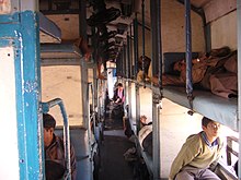
A typical sleeper class coach
At the rear of the train is a special compartment known as the guard's cabin. It is fitted with a transceiver and is where the guard usually gives the all clear signal before the train departs. A standard passenger rake generally has four general compartments, two at the front and two behind, of which one is exclusively for ladies. The exact number varies according to the demand and the route. A luggage compartment can also exist at the front or the back. In some trains a separate mail compartment is present. In long-distance trains a pantry car is usually included in the centre. A new class; Economy AC three tier is introduced in the Sealdah-New Delhi Duronto train.

Notable trains and achievements


A train on the Darjeeling Himalayan Railway
There are two UNESCO World Heritage Sites on IR — the Chatrapati Shivaji Terminus and the Mountain railways of India. The latter is not contiguous, but actually consists of three separate railway lines located in different parts of India:
  • The Darjeeling Himalayan Railway, a narrow gauge railway in West Bengal.
  • The Nilgiri Mountain Railway, a metre gauge railway in the Nilgiri Hills in Tamil Nadu.
  • The Kalka-Shimla Railway, a narrow gauge railway in the Shivalik mountains in Himachal Pradesh.
The Palace on Wheels is a specially designed train, frequently hauled by a steam locomotive, for promoting tourism in Rajasthan. On the same lines, the Maharashtra government introduced the Deccan Odyssey covering various tourist destinations in Maharashtra and Goa, and was followed by the Government of Karnataka which introduced the Golden Chariot train connecting popular tourist destinations in Karnataka and Goa. However, neither of them has been able to enjoy the popular success of the Palace on Wheels.
The Samjhauta Express is a train that runs between India and Pakistan. However, hostilities between the two nations in 2001 saw the line being closed. It was reopened when the hostilities subsided in 2004. Another train connecting Khokhrapar (Pakistan) and Munabao (India) is the Thar Express that restarted operations on February 18, 2006; it was earlier closed down after the 1965 Indo-Pak war. The Kalka Shimla Railway till recently featured in the Guinness Book of World Records for offering the steepest rise in altitude in the space of 96 kilometre.

A Beyer Garratt 6594 Engine seen at the National Rail Museum
The Lifeline Express is a special train popularly known as the "Hospital-on-Wheels" which provides healthcare to the rural areas. This train has a carriage that serves as an operating room, a second one which serves as a storeroom and an additional two that serve as a patient ward. The train travels around the country, staying at a location for about two months before moving elsewhere.
Among the famous locomotives, the Fairy Queen is the oldest operating locomotive in the world today, though it is operated only for specials between Delhi and Alwar. John Bull, a locomotive older than Fairy Queen, operated in 1981 commemorating its 150th anniversary. Kharagpur railway station also has the distinction of being the world's longest railway platform at 1,072 m (3,517 ft). The Ghum station along the Darjeeling Toy Train route is the second highest railway station in the world to be reached by a steam locomotive. The Mumbai–Pune Deccan Queen has the oldest running dining car in IR.
The Himsagar Express, between Kanyakumari and Jammu Tawi, has the longest run in terms of distance and time on Indian Railways network. It covers 3,745 km (2,327 mi) in about 74 hours and 55 minutes. The Bhopal Shatabdi Express is the fastest train in India today having a maximum speed of 150 km/h (93 mph) on the Faridabad–Agra section. The fastest speed attained by any train is 184 km/h (114 mph) in 2000 during test runs.
The Rajdhani Express and Shatabdi Express are the superfast, fully air-conditioned trains that give the unique opportunity of experiencing Indian Railways at its best. In July 2009, a new non-stop train service called Duronto Express was announced by the railway minister Mamata Banerjee.

Fares and ticketing

Fares on the Indian Railways across categories are among the cheapest in the world. In the past few years, despite a recessionary environment, the Indian Railways have not raised fares on any class of service. On the contrary, there has been a minor dip in fares in some categories.
Ticketing services are available at all major and minor railway stations across India. In 2003, Indian Railways launched online ticketing services through the IRCTC website. Apart from E-tickets, passengers can also book I-tickets that are basically regular printed tickets, except that they are booked online and delivered by post.

Tourism

IRCTC takes care of the tourism operations of the Indian Railways. The Indian Railways operates several luxury trains such as Palace on Wheels, Golden Chariot, Royal Orient Express and Deccan Odyssey; that cater mostly to foreign tourists. For domestic tourists too, there are several packages available that cover various important tourist and pilgrimage destinations across India.

Freight


A single line rail bridge
IR carries a huge variety of goods ranging from mineral ores, fertilizers and petrochemicals, agricultural produce, iron & steel, multimodal traffic and others. Ports and major urban areas have their own dedicated freight lines and yards. Many important freight stops have dedicated platforms and independent lines.
Indian Railways makes 70% of its revenues and most of its profits from the freight sector, and uses these profits to cross-subsidise the loss-making passenger sector. However, competition from trucks which offer cheaper rates has seen a decrease in freight traffic in recent years. Since the 1990s, Indian Railways has switched from small consignments to larger container movement which has helped speed up its operations. Most of its freight earnings come from such rakes carrying bulk goods such as coal, cement, food grains and iron ore.
Indian Railways also transports vehicles over long distances. Trucks that carry goods to a particular location are hauled back by trains saving the trucking company on unnecessary fuel expenses. Refrigerated vans are also available in many areas. The "Green Van" is a special type used to transport fresh food and vegetables. Recently Indian Railways introduced the special 'Container Rajdhani' or CONRAJ, for high priority freight. The highest speed notched up for a freight train is 100 kilometres per hour (62 mph) for a 4,700 metric tonne load.
Recent changes have sought to boost the earnings from freight. A privatization scheme was introduced recently to improve the performance of freight trains. Companies are being allowed to run their own container trains. The first length of an 11,000-kilometre (6,800 mi) freight corridor linking India's biggest cities has recently been approved. The railways has increased load limits for the system's 225,000 freight wagons by 11%, legalizing something that was already happening. Due to increase in manufacturing transport in India that was augmented by the increase in fuel cost, transportation by rail became advantageous financially. New measures such as speeding up the turnaround times have added some 24% to freight revenues.

Dedicated Freight Corridor

Ministry of Railways have planned to construct a new Dedicated Freight Corridor (DFC) covering about 2762 route km on two corridors, Eastern Corridor from Ludhiana to Sone Nagar and Western Corridor from Jawahar Lal Nehru Port Mumbai to Tughlakabad/Dadri along with interlinking of two corridors at Khurja. Upgrading of transportation technology, increase in productivity and reduction in unit transportation cost are the focus areas for the project.
“Dedicated Freight Corridor Corporation of India Limited (DFCC)” is a special purpose vehicle created to undertake planning & development, mobilization of financial resources and construction, maintenance and operation of the Dedicated Freight Corridors. DFCC has been registered as a company under the Companies Act 1956 on 30 October 2006.

Rail budget and finances


A sample ticket
The Railway Budget deals with planned infrastructure expenditure on the railways as well as with the operating revenue and expenditure for the upcoming fiscal years, the public elements of which are usually the induction and improvement of existing trains and routes, planned investment in new and existing infrastructure elements, and the tariff for freight and passenger travel. The Parliament discusses the policies and allocations proposed in the budget. The budget needs to be passed by a simple majority in the Lok Sabha (Lower House). The comments of the Rajya Sabha (Upper House) are non-binding. Indian Railways is subject to the same audit control as other government revenue and expenditures. Based on anticipated traffic and the projected tariff, requirement of resources for capital and revenue expenditure of railways is worked out. While the revenue expenditure is met entirely by railways itself, the shortfall in the capital (plan) expenditure is met partly from borrowings (raised by Indian Railway Finance Corporation) and the rest from Budgetary support from the Central Government. Indian Railways pays dividend to the Central Government for the capital invested by the Central Government.
As per the Separation Convention (on the recommendations of the Acworth Committee), 1924, the Railway Budget is presented to the Parliament by the Union Railway Minister, two days prior to the General Budget, usually around 26 February. Though the Railway Budget is separately presented to the Parliament, the figures relating to the receipt and expenditure of the Railways are also shown in the General Budget, since they are a part and parcel of the total receipts and expenditure of the Government of India. This document serves as a balance sheet of operations of the Railways during the previous year and lists out plans for expansion for the current year.
The formation of policy and overall control of the railways is vested in Railway Board, comprising the Chairman, the Financial Commissioner and other functional members of Traffic, Engineering, Mechanical, Electrical and Staff departments.
Indian Railways, which a few years ago was operating at a loss, has, in recent years, been generating positive cash flows and been meeting its dividend obligations to the government, with (unaudited) operating profits going up substantially. The railway reported a cash surplus of INR 9000 cr in 2005, INR 14000 cr in 2006, INR 20,000 cr in 2007 and INR 25,000 cr for the 2007-2008 fiscal year. Its operating ratio improved to 76% while, in the last four years, its plan size increased from INR 13,000 cr to INR 30,000 cr. The proposed investment for the 2008-2009 fiscal year is INR 37,500 cr, 21% more than for the previous fiscal year. Budget Estimates-2008 for Freight, Passenger, Sundry other Earnings and other Coaching Earnings have been kept at INR 52,700 cr, INR 21,681 cr, INR 5,000 cr and INR 2,420 cr respectively. Maintaining an overall double digit growth, Gross Traffic Earnings have been projected as INR 93,159 crore in 2009-10 (19.1 billion USD at current rate), exceeding the revised estimates for the current fiscal by INR 10,766 crore. Around 20% of the passenger revenue is earned from the upper class segments of the passenger segment (the air-conditioned classes).
The Sixth Pay Commission was constituted by the Government of India in 2005 to review the pay structure of government employees, and submitted its recommendations in April 2008. Based on its recommendations, the salaries of all Railways officers and staff were to be revised with retrospective effect w.e.f. January 1, 2006, resulting in an expenditure of over Rs. 13000 crore in 2008-09 and Rs. 14000 crore in 2009-10. Consequently, staff costs have risen from 44% of ordinary working expenses to 52%.

 Issues

Most of the railway stations are in gross disrepair, dirty, outdated and overcrowded. It is common to see passengers on trains hanging out windows and even on the roof creating safety problems. The interior of the trains are poorly maintained - "very dirty, broken seats, filthy toilets, loose wires tangled in the passageways, chipped paint, and the usual stinks." The railway has not yet been successful in addressing the overcrowding, cleanliness and other maintenance issues. Although accidents such as derailment and collisions are less common in recent times, many are run over by trains, especially in crowded areas. Indian Railways have accepted the fact that given the size of operations, eliminating accidents is an unrealistic goal, and at best they can only minimize the accident rate. Human error is the primary cause, leading to 83% of all train accidents in India. While accident rates are low - 0.55 accidents per million train kilometre, the absolute number of people killed is high because of the large number of people making use of the network. While strengthening and modernisation of railway infrastructure is in progress, much of the network still uses old signalling and has antiquated bridges. Lack of funds is a major constraint for speedy modernisation of the network, which is further hampered by diversion of funds meant for infrastructure to lower-prioritised purposes due to political compulsions. In order to solve this problem, the Ministry of Railways in 2001 created a non-lapsible safety fund of Rs. 17000 crore exclusively for the renewal of overaged tracks, bridges, rolling stock and signalling gear. In 2003, the Ministry also prepared a Corporate Safety Plan for the next ten years with the objective of realising a vision of an accident-free and casualty-free railway system. The plan, with and outlay of Rs. 31835 crore, also envisaged development of appropriate technology for higher level of safety in train operation.

Reforms and upgrades


One line Tunnel at Guntur division
Outdated communication, safety and signaling equipment, which used to contribute to failures in the system, is being updated with the latest technology. A number of train accidents happened on account of a system of manual signals between stations, so automated signaling is getting a boost at considerable expense. It is felt that this would be required given the gradual increase in train speeds and lengths, that would tend to make accidents more dangerous. In the latest instances of signaling control by means of interlinked stations, failure-detection circuits are provided for each track circuit and signal circuit with notification to the signal control centres in case of problems. Though currently available only in a small subset of the overall IR system, anti-collision devices are to be extended to the entire system. Aging colonial-era bridges and century-old tracks also require regular maintenance and upgrading.

Comparison of different gauges common in India with the standard one, which is not common in India
The fastest trains of Indian Railways, Rajdhani Express and Shatabadi Express face competition from low-cost airlines since they run at a maximum speed of only 150 kilometres per hour (93 mph). At least six corridors are under consideration for the introduction of high speed bullet trains to India with expert assistance from France and Japan.
IR is in the process of upgrading stations, coaches, tracks, services, safety, and security, and streamlining its various software management systems including crew scheduling, freight, and passenger ticketing. Crew members will be able to log in using biometric scanners at kiosks while passengers can avail themselves of online booking. Initially, various upgrade and overhaul work will be performed at more than five hundred stations, some of it by private contract. All metre gauge lines in the country will be converted to broad gauge (see Project Unigauge). New LHB stainless steel coaches, manufactured in India, have been installed in Rajdhani and Shatabdi express trains. These coaches enhance the safety and riding comfort of passengers besides having more carrying capacity, and in time will replace thousands of old model coaches throughout Indian Railways. More durable and conforming polyurethane paint is now being used to enhance the quality of rakes and significantly reduce the cost of repainting. Improved ventilation and illumination are part of the new scheme of things, along with the decision to install air brake systems on all coaches. New manufacturing units are being set up to produce state-of-the-art locomotives and coaches. IR is also expanding its telemedicine network facilities to further give its employees in far-flung and remote areas access to specialized medicine. IR has also piloted Internet connectivity on the Mumbai-Ahmedabad Shatabdi Express, powered by Techno Sat Communications It is estimated that modernisation of IR and bringing it up to international standards would require US$280 billion in new upgrades and investment from 2010 to 2020.
Sanitation in trains and stations throughout the system is getting more attention with the introduction of eco-friendly, discharge-free, green (or bio-) toilets developed by IIT Kanpur. Updated eco-friendly refrigerant is being used in AC systems while fire detection systems will be installed on trains in a phased manner. New rodent-control and cleanliness procedures are working their way into the many zones of IR. Central Railway's 'Operation Saturday' is gradually making progress, station by station, in the cleanup of its Mumbai division.
Augmentation of capacity has also been carried out in order to meet increasing demand. The number of coaches on each train have been increased to 24, from 16, which increased costs by 28% but increased revenues by 78%. The railways were permitted to carry 68 tons per wagon, up from the earlier limit of 54 tons per wagon, thereby cutting costs. The turnaround time for freight wagons was reduced from 7 days to 5 by operating the goods shed 24X7, electrifying every feeder line (this reduced time spent switching the engine from diesel to electric or from electric to diesel). Reducing the turnaround time meant that the Railways could now load 800 trains daily, instead of 550 trains daily. The minimum tonnage requirements were reduced allowing companies to unload their cargo at multiple stops